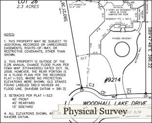
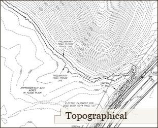
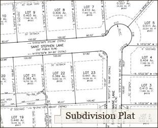
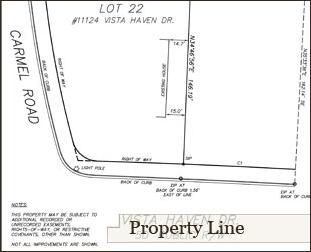
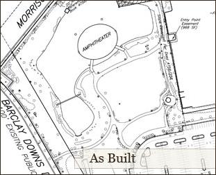
ADDITION STAKING: Staking services used for positioning new additions on existing structures. ALTA/ACSM SURVEY: A very detailed asbuilt survey often required by lending institutions and is accompanied with a title commitment. The request for this survey must be in writing and include all of the deeds and easements affecting the property, along with the deeds to adjoining properties. ASBUILT: A survey of the physical improvements as they are built on the property. BOUNDARY SURVEY: A survey of the boundary of property according to the description in the recorded deed. CONSTRUCTION SERVICES: Services include but not limited to staking clearing limits, pipes, streets, building pads, curb and gutter, sidewalks, building corners, elevator shafts, etc. FEMA FLOOD SERVICES: Services include but not limited to determining flood elevations for an area, locating flood lines, revising flood maps for areas of fill, FEMA mapping revisions. FLOOD CERTIFICATES: Surveys resulting in a document stating the impact of flood risk to a structure on a parcel of land in the vicinity of a flood prone hazard area. FOUNDATION SURVEYS: A survey used to show the size and location of a structure under construction in order for financial draws from lending institutions during construction. HOUSE STAKING: Staking services used for positioning new structures on parcels of land. LEGAL DESCRIPTIONS: A written paragraph describing a tract of land derived from a boundary survey. PHYSICAL SURVEYS: A boundary survey of residential property which includes mapping of all the improvements within the property and is often required for the acquisition of a loan for a property closing. PROPERTY LINE STAKING: Staking services used for determining property lines on the ground. This service includes an exhibit map that creates a record of what was surveyed and any improvements meandering the line at the time of the survey. SITE PLANS: A service used in creating a drawing showing the proposed improvements to be used to for approval process in neighbor hood with Home Owner Associations, Architectural Review Committees, local municipalities or other governing bodies. SUBDIVISION PLATTING: A survey which creates smaller parcels of land from large tracts for use in creating lots in neighborhoods or dividing up the family farm in compliance with local subdivision regulations. TOPOGRAPHICAL SURVEY: A survey which maps the elevation differences of a piece of property. Contour lines are used to illustrate the changes of elevation. All physical features and utilities are shown and the map is used for planning and design purposes. |
||
 |
|
Carolina Surveyors, Inc. • (o) 704-889-7601• (f) 704-889-7614 • Home • About Us • Services • Gallery • Contact |
||


WE APPRECIATE THE OPPORTUNITY TO SERVE YOU.
From individual property owners, to developers, to government agencies, we provide personal and quality service. Our dedicated managers will work with you throughout the project keeping your best interests in mind. We hope this gives you the best experience possible.

OUR SERVICES: